
| Wednesday, 04 Dec 2024 |
1940 U.S. Census Map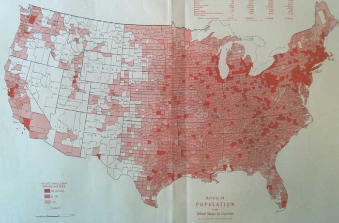 The United States was comprised of just 48 states in 1940. It wasn't until 1959 that both Alaska and Hawaii became states. Follow this link to view a more detailed 1940 U.S. Map  You may find the following 1940 Census map related links helpful: Search Census Records at MyHeritage.com If you know of other 1940 census or other helpful genealogy sites, please contact us. |