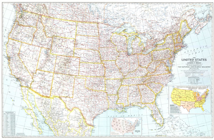
1940 United States Map

The United States was comprised of just 48 states in 1940.
It wasn't until 1959 that both Alaska and Hawaii became states.
Click the map above or this link to view a larger 1940 U.S. Map in a new window.

Search Census Records at MyHeritage.com
Other Useful Sites for Genealogy & Family History Research
As you research your family history, you will quickly realize the 1940 census is not the only source, nor can any one source answer all your questions. This is true for original source material, physical archives, and those archives that have been digitized and transcribed for online searching via the Internet.
Here are some other genealogy sites our visitors have found useful:
 ¤ Genealogy 101 Tips for Beginners & Free forms
¤ FamilySearch (The Church of Jesus Christ of Latter-day Saints)
¤ Ellis Island (The Statue of Liberty-Ellis Island Foundation)
¤ American Immigrant Wall of Honor at Ellis Island
¤ 1880 Census - free details for researching 1880 census records
¤ 1900 Census - free details for researching 1900 census records
¤ 1930 Census - free details for researching 1930 census records
¤ Vital Records tips at The Family History Zone
¤ New York Passenger Lists, detail about the Port of NY
¤ SteveMorse.org (One Step Search - including 1940 census)
¤ Genealogy Books (Google Your Family Tree)
¤ Genealogy Forms (Free Downloadable Charts & Forms)
¤ APG (Association of Professional Genealogists)
¤ Eastman's Online Genealogy Newsletter (by Dick Eastman)
¤ Internet Genealogy (from the publishers of Family Chronicle)

If you know of other 1940 census or other helpful genealogy sites, please contact us.
| 


 ¤
¤